MOUNT NUN 7135M EXPEDITION
EXPEDITION OVERVIEW
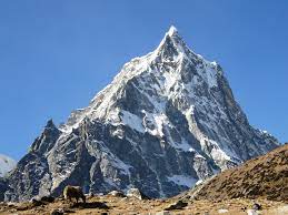
Mount Nun, standing at 7135 meters, is also a prominent peak within the Nun-Kun massif located in the Zaskar Range of the Himalayas in northern India. The Nun-Kun massif, situated in Leh Ladakh. It also comprises two peaks: Mount Nun 7135M, the highest peak in the region, and Mount Kun 7077M. Climbing Mount Nun presents an exceptional opportunity to acquire high-altitude climbing experience on a classic Himalayan expedition and progress to even higher peaks such as 7500M+ or even some less-technical 8000M peaks. Our team at Namas Adventure/Expedition highly values safety, as such we do not accept climbers without prior peak climbing experience. It is imperative that we firmly check and verify your previous alpine/mountain climbing experience before accepting you into the expedition.
Mount Nun also offers an accessible and relatively short approach to its base camp, making it one of the most sought-after climbing expeditions in the Indian Himalayas. With a grading of AD/4, the climbing route includes a mix of technical climbing and glacier travel. The ideal climbing period for Mount Nun is from June through August, a time when many other Himalayan regions (Nepal) experience the monsoon. This also makes it an excellent choice for climbers seeking a remote 7000M+ mountain expedition with a unique cultural experience. Our team will be climbing via the western ridge, which is considered safer and more accessible.
Although Mount Nun is also considered a semi-technical climb. It is essential that climbers maintain a high level of physical fitness throughout the expedition. This is also a great opportunity for those looking to venture into an accessible 7000M climb and experience a classic mountaineering adventure.
The region of Ladakh, located in Northern India and sharing borders with China/Tibet to the east and Pakistan to the north, is renowned for its stunning natural beauty. Heavily influenced by Tibetan culture, the valley offers breathtaking landscapes of high mountain passes, towering peaks, and glaciers. It also gives us the opportunity to explore and learn about the Buddhist monasteries steeped in the region’s history. It’s an ideal place for culture enthusiasts and adventure seekers.
Prerequisites: Kilimanjaro, Mt. Elbrus, Lobuche East & Island Peak, Chulu West, Khumbu 3 Peak expeditions, Aconcagua, Mt, Blanc. 4000M – 6000M climbing experiences.
History:
The first ascent of Nun was in 1953 by a French-Swiss-Indian–Sherpa team also led by Bernard Pierre and Pierre Vittoz, via the west ridge.
EXPEDITION HIGHLIGHTS
- Mt. Nun 7135M climb and acclimatization/training at Stok Kangri 6153M or alternative 6000M peaks
- West ridge, Camp 1,2 & 3 Strategy
- 12 days of the climbing period (Rotations, rest days, contingency days)
- Nepalese Sherpa guide leader with previous 8000M and 7000M- 6000M peak leading/climbing experience in their portfolio. 1.3:2 Guide/client ratio. 3 Guide members for every 4 client members.
- Ladhak Valley, Zanskar region
- Extension Mt. Kun 7077M Expedition (Please inquire)
Itinerary
-
Day 1 Arrival Delhi
Upon arrival in Delhi, the bustling capital city of India, you’ll be immediately immersed in a vibrant blend of modernity and tradition. The city’s sprawling metropolis greets you with its dynamic energy, marked by a mix of historical landmarks, contemporary architecture, and an unceasing flow of people and vehicles. As you navigate through Delhi’s streets, you’ll encounter an array of sensory experiences: the aroma of street food, the cacophony of traffic, and the vibrant colors of local markets. Whether you’re exploring the historic Red Fort, the serene Lotus Temple, or simply savoring the diverse culinary delights, Delhi offers a fascinating prelude to your journey. Take some time to rest and acclimatize to the time zone and climate, ensuring you’re refreshed and ready for the adventure that lies ahead in the Himalayas.
-
Day 2 Briefing at Indian Mountaineering Foundation (IMF)
Before embarking on your Mount Nun expedition, a detailed briefing at the Indian Mountaineering Foundation (IMF) in Delhi is essential. The IMF, the apex body for mountaineering and allied sports in India, serves as the hub for all administrative and logistical preparations. During the briefing, you’ll meet with experienced mountaineers and officials who will provide comprehensive information on the route, weather conditions, and safety protocols. You’ll review the required permits, equipment checklists, and emergency procedures, ensuring that every aspect of the climb is meticulously planned. This session also offers an opportunity to ask questions and clarify any doubts, fostering a sense of preparedness and confidence among the team members. The IMF briefing sets the stage for a well-organized and safe expedition, reinforcing the importance of thorough preparation and teamwork.
-
Day 3 Delhi - Leh (Flight)
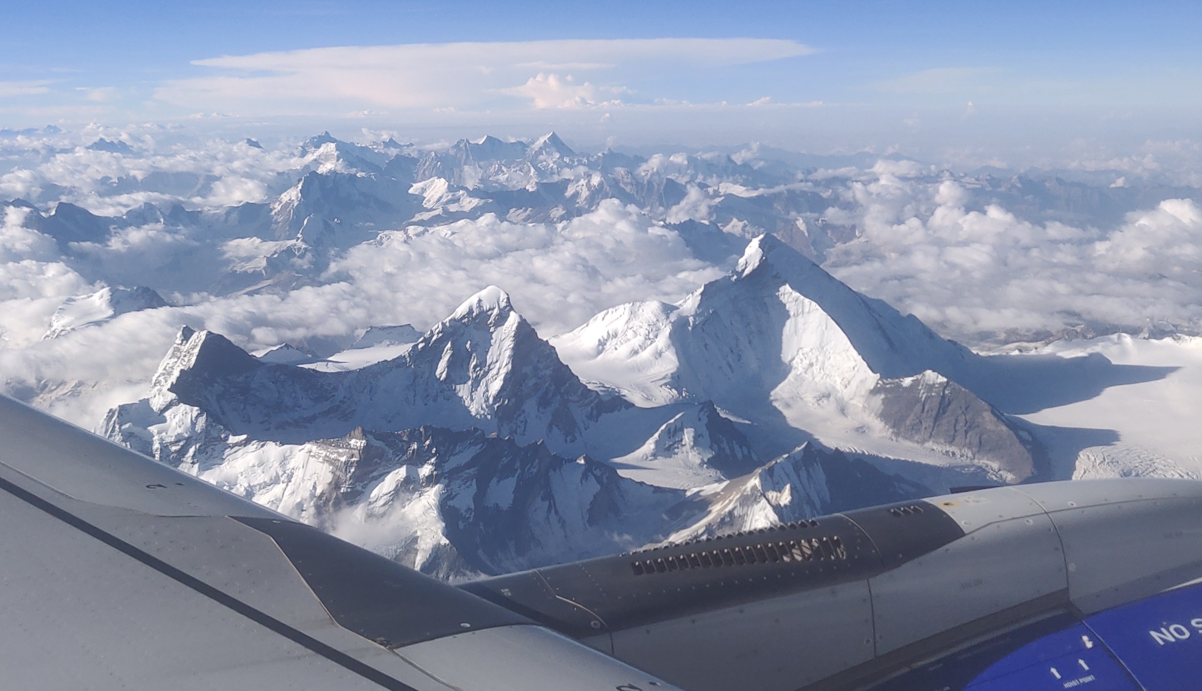
The flight from Delhi to Leh offers a breathtaking transition from the bustling plains of the capital to the serene heights of the Ladakh region. As the plane ascends, you’ll soon leave behind the urban sprawl of Delhi, with its patchwork of buildings and winding roads, and soar above the clouds. The landscape below gradually shifts from the fertile plains to the rugged terrain of the Himalayas. As you approach Leh, the view from your window transforms into a stunning panorama of snow-capped peaks, deep valleys, and winding rivers. The descent into Leh is particularly mesmerizing, as the plane navigates through mountain passes, providing an exhilarating preview of the adventure ahead. Landing in Leh, situated at an altitude of 3,500 meters (11,500 feet), you’ll be greeted by the crisp, thin air and the unique blend of natural beauty and cultural richness that defines this high-altitude desert region.
-
Day 4 Leh Acclimatisation and tours in Leh
Day four is reserved for rest and acclimatization to the altitude. This is important to allow your body to adapt to its new environment and reduce chances of adverse health conditions. You can go around and explore the city market, delve into the colors and culture of this high-mountain city and visit some places nearby. A little movement around the city would be good for acclimatization. Also, use this time to go through your checklist and do some last-minute shopping for what you might be missing for the expedition. Leh has the best market for trekking essentials.
While the body acclimatizes, we take this time to get together with the group for a debriefing session where we get to know each other better and delve into the happenings of the next few days – schedule, what to expect, basic do’s and don’ts in the mountains, how to maintain the sanctity of the environment and other such matters of importance.
-
Day 5 Leh - Kargil
Distance: 217 kms
Time Taken: 6-7 hour drive
Today is a big day! It is the official beginning of the actual expedition when you will be driving straight towards Mount Nun. You will also meet the Sherpas and other support staff, a vital part of this team. Expect to leave after breakfast. The drive should take close to 6-7 hours. By now you would be familiar with the terrain and roads of Ladakh. Barren landscape, smooth roads and the flavoured air make the seven hour drive seem like a visit to the neighbours!
-
Day 6 Kargil - Tangol
Distance: 65 kms
Time Taken: 2 hours
You drive down from Kargil to get to the head trail of Mt. Nun, a small village by the Suru river, called Tangol. Today starts with no sense of urgency in anyone’s gait because the distance to be covered is very small. The drive is all of two hours but has the capacity to cleanse your soul in that short period. You lose your cellular networks as soon as you head out of Kargil and can concentrate fully on what the landscape outside the window of your car has to offer. Narrow roads, lush green villages, people carrying stacks of firewood on their backs, the greens against the barren brown mountains, and a special scent in the air. As you drive up the mountain, towards a higher altitude, you chance upon a bird’s eye view of mountain life on the lower flanks of the mountain. Farming, small kitchen gardens behind every stone structured house – you start to realize how self-sustained the ecosystem of mountain life actually is. People bowed down with sickles, working their land mirroring the humility of high-altitude living. Notice how the houses have high ceilings but low doors which need you to bend down in order for you to enter without banging your head – there is humility in every aspect of mountain culture. Is it a mystery then, what version of yourself you are expected to bring to the mountain face when you come here for a climb?
Half an hour into the drive, the valley opens up, and as if experiencing a sudden growth spurt, the river grows much wider. The mountains get smoother and greener; streams of clean water cascading down from all sides enter and join the river on its quest.
Fifteen more minutes and you get your first glimpse of snowy peaks which is a welcome change in the color palette of the landscape, drenched in an assortment of earthen colors for the last few days. The white peaks that were peeping from behind are now bang in front of you, like you will drive straight into them.
A little further into your drive, you go from smooth roads to kachcha trails and get to the brown landscape of rocky mountains. The greens have now bowed their way out of the show. An assortment of big boulders in what looks like areas where the rocks have tetris-ed into each other welcomes you. The rows and rows and rows of apricot trees along with the smooth gray of the roads with the bright yellow line stretched out for as far as you can see, all add to the beauty and colour of the overall landscape.
Further evidence of a harmonized existence are the mud brown houses with wooden windows painted green mimicking the two predominant colours of the mountains that host this culture of living. Entire villages on pinnacles in the middle of the valley as you ride alongside the muddy and forceful Suru river is a sight to behold and it makes you wonder, do all villages dream of becoming towns, really?
Since we have gained some height today, we will also go for a small acclimatization walk in the evening.
-
Day 7 Tangol to Nun Base Camp
Distance: 7-8 kms
Time Taken: 7-8 hours trek
The actual trek starts today. You will slowly move towards the upper reaches of the mountains. We will try to leave right after breakfast because it is likely to be a long day. There is a height gain of 900M and the weight on your back does not make it easy. You start by crossing over the other side of the river through a sturdy bridge with a deep gorge and river underneath. This leads you to the last village you will visit before heading out of the boundary of civilization.
The route to basecamp takes you through small villages rich with lush green fields bordered with pink flowers and locals running up and down the steep slopes like it were an Olympic field. Cattle scattered around the landscape, you soon leave the geometric greens behind at the foothills of the mountain and enter the world of browns on narrow shepherd trails– rocks, boulders and mud – extremely dry but rich in flowers of all colors growing out in tufts from the cracks between the land.
The mountains here are peculiar – rocky with pointed peaks – completely brown and dry from a specific point upward with lush green fields at the foot of the slopes. You walk through boulders and scree on the many shepherd trails crisscrossed across the landscape dividing the dry greens into mounds of tufts.
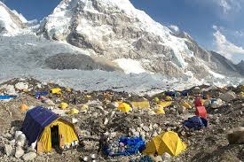
Three hours into the climb, you reach the pass. The landscape on the other side changes completely, and so does the air. After the steep ascend to get to the pass, you descend down into a much chillier valley – a bit more rustic than the one you left behind. On crossing miles of moraine and glaciers, you will make it to the bottom of the waterfalls. This last leg of the climb is steep (close to a 60 degree gradient) and slippery, thanks to the loose rocks and scree. The basecamp rests waiting for us at the top of the waterfall. Your last challenge is crossing streams of water from the waterfall to get to the warmth of your tents which will be your homes for the next few days to come.
-
Day 8 - 19 (12 Days of climbing, Base Camp. Puja ritual ceremony, contingency day, Training, and preparation for a summit bid. We will aim 1-2 rotations between Camps 1 & 3. Contingency days)
Once you step in to mountaineering, the conditions on high-altitude become unpredictable. There is a constant readjustment of plans to adapt to the situation at the time. Providing fixed day-wise schedules, like we do for treks, is tricky. But roughly, the schedule includes rotation rounds between camps which are a standard acclimatization process on high-altitude expeditions. Mt. Nun has 3 camps at 5,550M, 6,100M and 6,400M above the basecamp.
Camp 1 (5,500M): Camp 1 is at an altitude of 5500M which is a 900M vertical height gain from the Base Camp. The first stretch of this trail includes climbing two hours of a steep rocky slope after crossing the river over to the other side of the camps. This stretch is full of boulders and rocks but has a pretty well laid out trail which makes the ascent a little less grim. The two-hour climb takes you up the mountain ridge and down to the other side requiring you to walk on massive boulders – a stretch to be cautious on till you make it to something called a ‘Crampon Point’. This infamous point is an enormous rock with a little opening at the bottom, making it a perfect place to store all our equipment to protect it from the rain and from being blown away by angry winds. Consider it the green room for your trek – this is where you put all your gear on and get ready for the actual climb.
The most difficult section between Base Camp and Camp 1 is the 300M of a 75 degree gradient ice wall. After the first wall, there is an additional patch of steep ice which needs to be navigated. Once we cross the ice wall and its annex, the slopes get a bit gentler and the snow gets a little softer. You then turn to the right, jump over a few crevasses and reach the point where the slope is now at close to 30 degrees. This is the end of the fixed rope section and the start of the land of hidden crevasses. Camp 1 is bang in the middle of a 4kms wide snowfield. Walking the long flat land after a while starts to feel like walking into nothingness. You should reach your tents within 5-6 hours of leaving from Base Camp.
Camp 2 (6,100M): The path between Camp 1 and Camp 2 is a straight ascent, through and through, with slopes between 60-70 degrees. The entire stretch of the climb, which is a height gain of 600M from Camp 1, is likely to take an average of 9 hours for the climbers to cover. For the most part of the climb, depending on the texture of the snow, you will find yourself on front point! The most difficult part of the climb, however, remains navigating large sections of boulders and rocks with crampons on.
All these conditions aside, Camp 2 is absolutely mesmerizing. Mt. Nun, no doubt, has some of the most beautiful and the most thrilling high-altitude campsites. But of the three, Camp 2 is a class apart. It gives you the drama of a 007 film while creating the humor of a Black Jack movie. Resting precariously on a sloped and narrow ridge of a high pinnacle, tents on Camp 2 are literally dangling in the air. With an impossible slope on one side and a direct 800M drop on the other, even to answer nature’s call, you have to anchor yourself to the rope. However, whoever dares to look up could vouch for the fact that the campsite gave them some of the best morning and evening views they have ever witnessed. With the rest of the world hidden below clouds and a crack in the sky that added the orange to the otherwise white landscape is nothing short of magical. The sunlight on Mt. Nun from Camp 2, gives it a God-like halo captivating you further.
Camp 2 gives you such spectacular sights that the drama and thrill might just be bigger than the summit itself. The cloud show is amazing sitting at that height with an unobstructed view of the snowfield below. The dance of shadows of the clouds on the massive snow field is one show you definitely want front row seats to!
Camp 3 (6,400M): Camp 3, which is the Summit Camp, is at an altitude of 6400M which is a 300M vertical height gain from Camp 2. However, it is likely to feel not too taxing after having endured the daunting slopes to reach Camp 2. After the initial steep descent from the campsite, the rest of the route is mostly snow dunes which go up and down at a gradient of not more than 40 degrees. Much like Camp 1, Camp 3 is also stationed in the middle of a snowfield. Camp 2 to Camp 3 should take you close to 6 hours to cover.
Summit Push (7,135M): Like all other summits, it is vital to cover as much distance as possible through the night because that’s when the ice is most stable. You start the climb between 11 and 12 in the night. Hopefully all the anxiety and tension from all the physical and mental stress you put your body through the past few days, will dissolve into the calm of the night as you focus on the climb and the goal ahead. You will access the west ridge from Summit camp, which involves traversing on 40-60 degree ice after which the gradient comes down to 40-50 degrees. The last section with large boulders is especially tricky because of the crampons. It is exceptionally hard to carry your weight and pull yourself over the massive boulders after the extreme physical and mental fatigue from hours of ascent. Once the boulders are crossed, however, there is only around 50M more to get to the summit. Expect this round trip from Summit Camp to Summit Camp to take anywhere between 14-16 hours.
Camp 3 to Base Camp: This is going to be long day. Be prepared for very steep descends early in the morning– after breakfast. Descends can be precarious so try to keep yourself as focused as while going up the mountain – depleted energy has a way of defocusing your mind. Expect this ordeal to take anywhere between 8 to 10 hours to complete.
-
Day 20 BC to Kargil
The journey from Base Camp to Kargil marks the beginning of your descent from the high altitudes of Mount Nun back to more accessible terrain. As you break camp and begin the trek, the stark, icy landscape gradually gives way to more temperate surroundings. The descent through the glacier, though challenging, is eased by the relief of heading to lower altitudes. The path winds through rocky moraines, past glacial streams, and across verdant alpine meadows, offering a serene contrast to the ruggedness of the climb. Once you reach Tangol, the familiar sight of the vehicles waiting to take you to Kargil brings a sense of accomplishment and comfort. The drive from Tangol to Kargil, approximately 3-4 hours, is scenic, passing through picturesque villages and along the banks of the Suru River. As you arrive in Kargil, the vibrant town serves as a welcoming reprieve, with its bustling markets, friendly locals, and the warm hospitality of your accommodations. This leg of the journey not only provides a well-deserved rest but also offers a chance to reflect on the incredible achievements and experiences of the expedition.
-
Day 21 Kargil - Leh
The drive from Kargil to Leh is a spectacular journey through the heart of the Ladakh region, offering some of the most stunning landscapes in the Indian Himalayas. As you leave Kargil, the road winds through arid mountains and lush valleys, following the course of the Indus River. The changing scenery includes dramatic rock formations, verdant patches of farmland, and quaint villages that dot the roadside. Along the way, you’ll cross high-altitude passes such as Fotu La and Namika La, each providing panoramic views of the surrounding peaks and valleys. The descent from these passes reveals a tapestry of colorful prayer flags and ancient monasteries perched on hilltops, embodying the spiritual essence of the region. As you approach Leh, the air grows cooler and the landscape more barren, signaling your arrival in this historic city. Leh, with its blend of traditional Ladakhi culture and modern amenities, welcomes you with open arms, offering a perfect conclusion to the scenic and memorable drive from Kargil.
-
Day 22 Leh - Delhi (Flight)
The flight from Leh to Delhi marks the final leg of your journey, offering a breathtaking farewell to the majestic Himalayas. As the plane ascends from Leh, you are treated to stunning aerial views of the rugged, snow-capped peaks and winding river valleys that characterize this high-altitude desert. The transition from the serene, mountainous landscape of Ladakh to the bustling urban sprawl of Delhi is both swift and striking. Upon landing in Delhi, the city’s vibrant energy welcomes you back with its familiar sights and sounds. After disembarking, you’ll have time to gather your belongings and reflect on the incredible experiences of your expedition.
-
Day 23 Final Departure
Whether you choose to explore Delhi’s rich cultural heritage one last time or simply rest before your departure, the city serves as a fitting backdrop to conclude your adventure. As you prepare for your final departure from Delhi, the memories of your journey, from the challenging ascent of Mount Nun to the cultural immersion in Ladakh, will remain with you, marking the end of an unforgettable expedition.
Include / Exclude
Cost Includes:
-
WHAT’S INCLUDED
- Namas Nepalese Sherpa guides with previous 8000M and 6000M peak leading and climbing experience in their portfolio. 1.3:2 Guide client ratio. i.e.- 3 Guide members for every 4 client members.
- Guide for monasteries
- Fixed ropes and equipment for fixing ropes
- All accommodations in Delhi and Leh with breakfast
- Gas and burners for high camps
- All camping equipment including sleeping tent, foam mattress, mess tent, dining tent and toilet tent
- All meals and drinks while trekking and climbing
- Service of horses or mules and their drivers
- Liaison officer’s fee to the IMF, accommodation, and transportation
- Porters for all the equipment, gear, and food
- All monastery entrance fees and camping fees
- Namas Branded merchandise (Down Jacket, Cap, Buff)
- Head chef and 2 kitchen helpers (Helpers increase with the number in climbing team members )
- Emergency Supplemental oxygen + 1 cylinder
- 2 night before the expedition and 1 day after the expedition. Hotel in Delhi. (Should clients return early from their expedition, clients will be responsible for their extra Delhi hotel bookings)
- All climbing permits
- All internal-local transportation to and from the trekking trailhead
- Expedition tents (2 or 1-person tents) Brands Salewa, Mountain Hardwear, Samaya equipment, Kailas
- 40 kgs personal weight (Extra additional weight, clients will need to hire an additional porter. Estimated $1000 USD for 27 days)
- Chocolate, energy bars, hydration pills, biscuits, canned foods, nuts
- Burners and expedition equipment
- Breakfast, Lunch and Dinner on trek and expedition days.
- Lodge accommodation during the trek
- Basic First aid kit
- Pick up from Delhi Airport, Leh Airport, and return to Leh Airport.
- Welcome or Farewell leave Dinner
Cost Excludes:
WHAT’S NOT INCLUDED
- International Flights
- Personal clothes, personal climbing gear, and sleeping
- bag
- Medical and evacuation insurance
- Lunch and dinner in Leh (breakfast is included with accommodation)
- Laundry services
- Other services not mentioned in the package
- Extra cost if the expedition finishes early and the cost arising from early departures
- Tipping our crew.
Price per person
2024 MT. NUN 7135M EXPEDITION
23 DAYS
COST. . .
$8750 P/P
All-inclusive. Guaranteed departure. No extra hidden costs.
2024 MT. NUN DEPARTURES. . .
Summer 2024
8th – 30th July
MT NUN & MT KUN COMBO. . .
35 – 40 Days Expedition
MT. KUN EXTENSION + 5 – 7 DAYS. . .
Usefull Information
EXPEDITION STRATEGY
- NUN 7135M EXPEDITION ROUTE
Base camp (4,500m / 14,763ft) to Camp 1 (5,500m / 18,045ft, 5-6 hours)
The route to camp 1, includes ascending steep scree slopes and rocky moraine before reaching the glacier. Once on the glacier, we will use 250 meters of fixed lines to navigate crevasses and continue the ascent. Our team will establish Camp 1 on a spacious snow plateau, providing a comfortable base for further climbing.
Camp 1 (5,500m / 18,045ft) to Camp 2 (6,100m / 20,013ft, 6+ hours)
The ascent of Mount Nun features a combination of mixed climbing on snow, ice, and rock. Climbers will utilize fixed lines to navigate and reach Camp 2, which is located on a crevassed col.
Camp 2 (6,100m / 20,013ft) to Camp 3 (6,400m / 20,997ft, 4+ hours)
The route involves roping up or using fixed lines to negotiate crevasses. We will climb ice slopes to reach the small plateau of Camp 3.
The route to camp 3, involves utilizing rope teams or fixed lines to navigate crevasses. Climbers will ascend ice slopes to reach the small plateau of Camp 3.
Summit day (7,135m / 23,409ft, 10+ hours)
The summit ascent involves navigating a steep slope of snow and ice, as well as challenging rock sections below a snow arete. The use of fixed lines will be required throughout this portion of the route. The summit view from the top of the mountain is truly spectacular.
Upon reaching the summit, we will begin our descent, making our way as far as possible back to the lower camps, such as Camp 3. The following day, we will continue our descent and return to the Nun Base Camp.
- NUN EXPEDITION BLOG ARTICLES
Equipment List
Clothing
Base Layers:
– Moisture-wicking thermal tops and bottoms
Insulation Layers:
– Fleece or down jackets and pants
Outer Layers:
– Waterproof and windproof shell jacket and pants (Gore-Tex or similar)
Down Suit:
– Full-body high-altitude down suit
Headgear:
– Warm hat or beanie
– Balaclava or buff
– Sun hat or cap
Handwear:
– Lightweight gloves for lower altitudes
– Insulated gloves or mittens for higher altitudes
– Over mitts
Footwear
Mountaineering Boots:
– High-altitude double or triple boots (e.g., La Sportiva Olympus Mons, Scarpa Phantom 8000)
Trekking Shoes:
– Lightweight trekking boots or shoes for lower altitudes
Gaiters:
– High-altitude gaiters to keep snow out
Socks:
– Moisture-wicking liner socks
– Heavyweight insulated socks
– Spare socks
Climbing Gear
Ice Axe:
– Lightweight ice axe for climbing
Crampons:
– High-quality crampons compatible with your boots
Climbing Harness:
– Lightweight mountaineering harness
Carabiners:
– Locking and non-locking carabiners
Ascenders:
– Mechanical ascender for fixed ropes
Belay/Rappel Device:
– ATC or similar belay device
Ropes:
– Personal prusik loops or short lengths of cord
Helmet:
– Climbing helmet
Camping Equipment
Tent:
– High-altitude expedition tent
Sleeping Bag:
– Down sleeping bag rated to at least -40°C (-40°F)
Sleeping Pad:
– Insulated inflatable or foam sleeping pad
Cooking Equipment:
– Stove and fuel (provided by the expedition team)
– Lightweight pot and utensils
Personal Gear
Backpack:
– Large backpack (60-80 liters) for carrying gear
– Small daypack (20-30 liters) for acclimatization hikes
Hydration:
– Water bottles (insulated for higher altitudes)
– Hydration system (optional)
Navigation:
– Map, compass, or GPS device
Headlamp:
– Headlamp with extra batteries
Sunglasses:
– High UV protection glacier glasses
Goggles:
– Ski goggles for protection in high winds
Sunscreen:
– High SPF sunscreen and lip balm
Miscellaneous
First Aid Kit:
– Personal first aid kit with altitude medications
Personal Hygiene:
– Toiletries (toothbrush, toothpaste, wet wipes)
– Hand sanitizer
Communication:
– Satellite phone or radio (often provided by the expedition)
Camera:
– Lightweight camera or smartphone for photos
Optional Items
Supplemental Oxygen:
– Oxygen bottles and mask/regulator set (typically provided by the expedition)
Books/Journal:
– Reading material or a journal for downtime
Snacks:
– Personal energy bars or snacks
This list covers the essential gear needed for the Mount Everest Express Expedition, ensuring climbers are well-prepared for the challenges of high-altitude climbing. Always consult with your expedition operator for any specific gear recommendations or requirements.
-
 Best Seasons March to May, September to November
 -
 Group Size 2-20
 -
 Duration 50 DAYS BOOKING OPEN
 -
 Maximum Altitude 7135M
 -
 Trek Difficulty Challenging



Leave a Reply